March 28, 2009
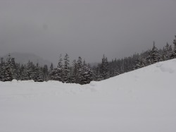
On this day, we decided that we would go and look at the Callaghan Valley where the ski jumps are located. We started out fairly early in the morning, and went up to the Sea to Sky corridor highway. We drive past Brittania Beach, and then we continue by Porteau Cove, and Brandywine Falls (completely snowed in still), and then our first stop is to look go down the Cat Lake Forest Service Road that is located in the Brohm Lake Park area. The road started to get too muddy, so we turned around, and there was still a lot of snow that was around. We continued on up the Sea to Sky Highway, and Brohm Lake, Daisy Lake, and Alpha Lake were completely frozen over. We then continue up to the Callaghan Valley. This is approximately 20 km SW of Whistler. There are actually 3 different Olympic Venues up in this area. The ones that are up in that particular area is the Biathalon, Ski Jump, and Cross-Country Skiing area. It was spectacular to see the job that they done with the ski jump. There were actually people who were practicing when we were up there. There was still quite a bit of snow in this region. It was snowing lightly, and very strong wind gusts at times which allowed for cold air. The Callaghan Valley is located approximately 12 km up from the Sea to Sky Corridor. This road was paved when we were coming down the Sea to Sky Corridor during the summer last year.
We then went to Nester's Market for some lunch items, and then we had a cheaper lunch, then we would have if we went to a restaurant in the Whistler area, which would probably cost 2-3 x more than what we paid for the lunch in the market.
After we had lunch, we decided to look at the SPCA located on the same street. We saw a couple of cats in the Cat room, and they were both very pretty, and purred whenever I came near them. Then we went into the sickbay area for a cat that was not too well. Unfortunately when we opened the door, the cat took a bee-line and hightailed it to the front door, but the staff member said that it usually did that, and we didn't have to worry about this.
After we finished here, we decided that we would go the backroad way to Alpha Lake to Whistler. We first went to this park that was at a first point near Alpha Lake, but the hill was too steep, and had way too much ice on it. We then drove past a Rainbow Valley trail, that would take too long, so we kept going until we came across Rainbow Park, which was a little bit further up. This was still very icy and snowy, but we managed to cross the Railroad track,and went near a small bridge. I took some nice pictures, and then went back to the car.
We then continued up the road until we got to the back part of Whistler,and then we headed down to Squamish and spent a little bit of time there, and then we went down towards the Sea to Sky Highway, and then we went back down to the Vancouver area.
We then went to Horseshoe Bay and spent a little bit of time looking around the harbour that the Ferry was located. There were some seagulls that posed for me, and I took some other pictures like of the totem poles and other stuff. We then went up Marine Drive, and then we took the passageway to Lighthouse Park, but we did not go hiking to see Point Atkinson, but we continued by the secluded boat harbour cove area, and then we went up to West Vancouver this way.
That was the end of this trip!

 RSS Feed
